Leary Bros. 2nd Mt. Shasta Summit Push. Success!
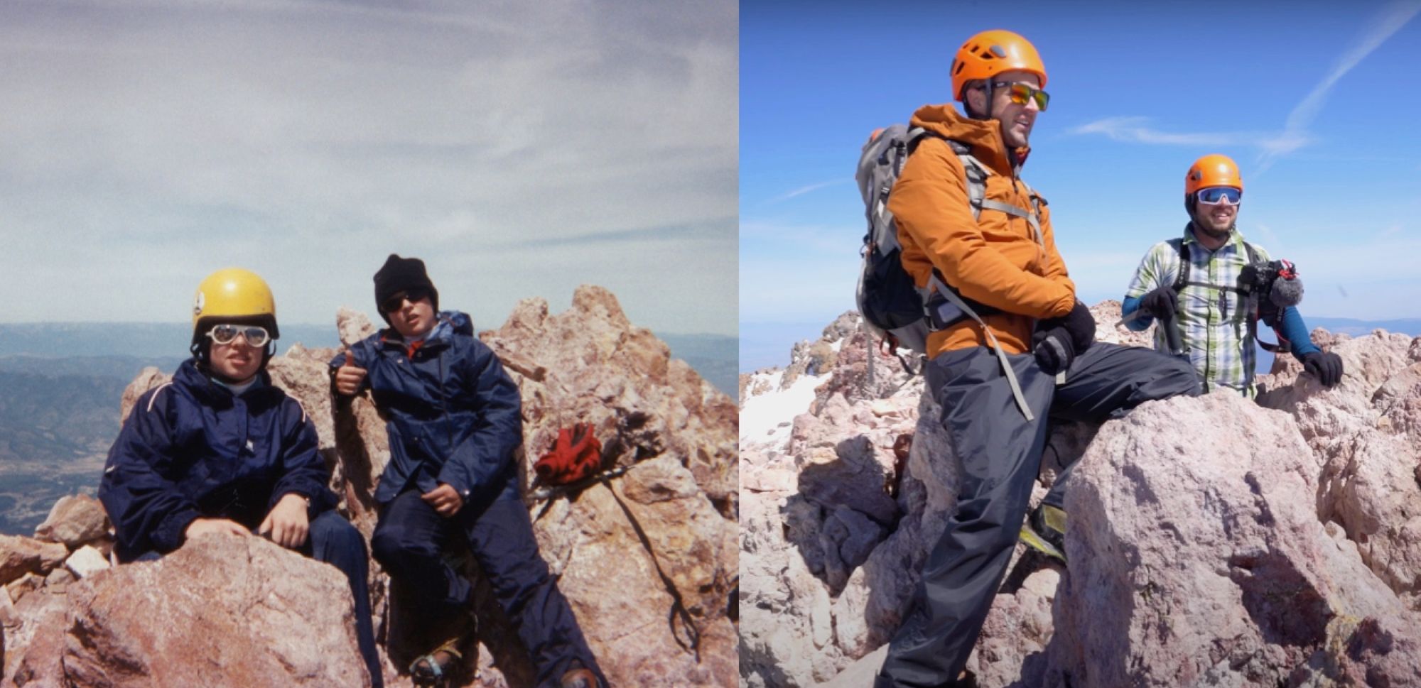
Ryan and I return to Shasta Summit Glory after 21 years, though this time we opt for a different and less-traveled route!
A Little Bit of History
When I was thirteen years old, my enlightened father decided that my Father's Day gift to him would be a summit attempt of Mt. Shasta. Thanks Dad? The mountain holds a special place in my heart as that Father's Day marks my earliest memory of overcoming a seemingly insurmountable obstacle. I vividly recalling collapsing in the snow above Misery Hill, summit in sight but still not under my feet, closing my eyes and praying that we could just turn around.
"Just five more minutes." says Dad. Of course he's already used that line a few hundred times already, but it's Father's Day. I guess he gets one final effort after a little more whining. We ditch any extra pack weight and make the push.
And we make it! I'm elated! All the self doubt and frustration disintegrates as euphoria and pride settles in. Though he came dangerously close to planting the seed to early, dad had caused a love of mountain challenge to sprout inside me.
Twenty one years later I've left active duty Navy and am counting down the days until my Pacific Crest Trail journey begins. Ryan, my brother, says "Hey I want to do Shasta, you down?" My calendar looks like a white board these days so I'm pretty quick to say yes. Our start date is only two weeks away. I actually like planning things last minute. Takes the anxiety out of it and forces you to always be ready for anything. I'm older and more experienced these days, and I'm in a pretty high state of physical fitness - beyond the pizza and video games of my thirteen year old self. Let's do it!


The Mountain
At 14,179 feet tall, Mt. Shasta is California's fifth highest mountain and a popular proving grounds for aspiring mountaineers. It's a potentially active volcano considered to be part of the Cascade mountain range which stretches north to British Columbia. However, you wouldn't guess it driving in from any direction. The mountain stands tall and alone among the surrounding pine forests.

The mountain is actually comprised of four overlapping volcanoes, each of which was formed at a different time. I said potentially because we don't really have any recent data on eruptions compared to the other nearby volcanoes. Most of its volcanic activity happened before recorded history, though from what I read it has had six eruptions in the last 2000 years, including reports in unverified reports from Spanish explorers in 1786 and a mention from the first summit party in 1854 of "a cluster of boiling sulphur hot springs ... located on the edge of a broad snowfield just below the summit pinnacle ... and the rocks are hot enough to cook an egg in five minutes." This site also provided warmth for John Muir and a climbing companion on May 1, 1877 as he describes in Snow-Storm on Mount Shasta.
"Here," said Jerome, as we stood shivering in the midst of the hissing, sputtering fumaroles, "we shall be safe from frost." "Yes," said I, "we can lie in this mud and gravel, hot at least on one side; but how shall we protect our lungs from the acid gases? and how, after our clothing is saturated with melting snow, shall we be able to reach camp without freezing, even after the storm is over? We shall have to await the sunshine; and when will it come?
Mt. Shasta has seven named glaciers, including Hotum which is the most voluminous in California. It's typically climbed in summer months when most of the snow has melted, but this has been a low snow year, so chances of scoring a summit without worrying about too much snow are good.
The Plan
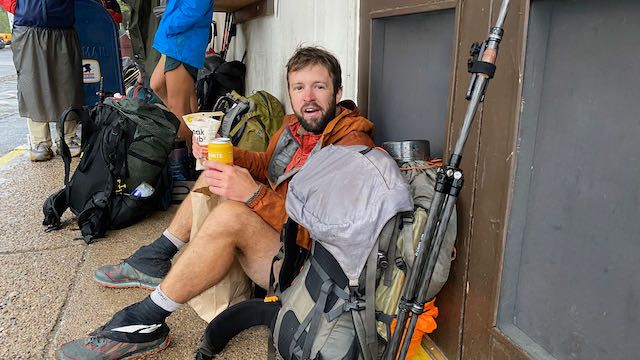
Lately, I've been hot on weekday adventures to avoid the crowds. Ryan got the week off work, so we set out on Monday from Truckee. It was a quick four hour drive up highway 395 to 89, with a quick stop to check out Burney Falls. We got to the town of Mt. Shasta in the late afternoon, where we picked up pizza at Say Cheese Pizza based on the checkout girl's recommendation. It's a classic pizza restaurant throwback to the days of Saturday afternoon after-soccer parties, complete with pool tables, arcade games, and sports on TV. Ryan and I hunkered down at the Time Crisis machine while we waited for our pizza.
We camped at Siskiyou Campground, only 10 minutes outside of town. It's not cheap at $35.50 per night for a tent site, but that's actually not bad these days for California. The amenities were great (showers, hot water, power), though we didn't really use any of them. The sites are right next to the lake and very popular among RV folks. We enjoyed our pizza at the camp picnic table then walked down with beer and cider to the lake shore to see if we could get a picture of Mt. Shasta's reflection. We attempted the same shot in the morning, but both times the wind was high enough that we couldn't quite get the reflection we were hoping for. It was still wonderful to sit and relax as the light crept down and up the mountain ridge lines.
Tuesday morning was for pre-hike errands and putting in some trail miles to base camp. We hit the following spots in order:
- Lake Siskiyou Resort Campground for the night and sunrise photos.
- Big Bear Diner - The Original Location!
- Mount Shasta Supermarket Deli for lunch later.
- Ranger Station. Inside was closed to public (COVID) but outside is everything you need - $25 wilderness permit, free summit permit, and free wag bags (yes, you have to carry out EVERYTHING).
- Fifth Season Gear Rentals. We both needed boots, crampons, and a helmet. The other necessary piece of gear is an ice axe, which we already had. We also got a larger all-season tent. Fifth Season has plenty of gear for purchase as well.
Huge shoutout to all the kind locals at these businesses. I really recommend all of them. For conditions and recommendations for your hike, the folks at Fifth Season are really in the know. If you have any questions about your trip, call them first. We were planning to hike the most popular route, Avalanche Gulch, via Bunny Flat trailhead, but based on their information about elevated rockfall danger in a low snow year on that route, we opted for Clear Creek Trailhead instead. While we were eager to relive the route we took so long ago, it's never a hard sell for me to see something new.
Despite being a low snow year, it was still early in the season. This meant that the Clear Creek trailhead was inaccessible by car and required us to walk along 3 miles of fire road before reaching the actual beginning of the trail. Also, most of the trail was covered in snow such that we had to do some route finding via GPS. The route finding was not particularly difficult. When in doubt, walk uphill, and don't drop down into mud Creek. Clear Creek trail follows a prominent ridge line up to Clear Creek Springs, which is a popular spot to make camp due to the free flowing delicious mountain spring water.
Camp for the night was a beautiful spot and we were the only ones there that Tuesday night. We had an early dinner and cowboy camped in our sleeping bags as soon as the sun set.
Alarms were set for 0330, and we were packed and away by 0415 after coffee and oatmeal.
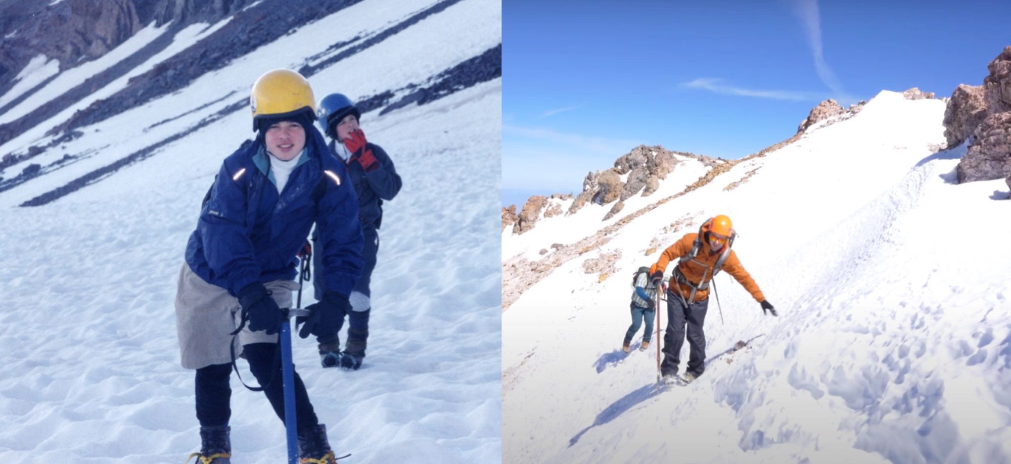
The next 7 hours to the summit were rather uneventful, which is how I prefer my mountaineering expeditions. It's all steep - about 6000 feet of elevation gain in just 3 miles. We hiked up and up and up, stopping occasionally to drink water, nibble on bars, and adjust clothes. The initial mile from Clear Creek Springs followed a well trodden part up loose dirt and rocks which eventually gave way to steep snow banks plastered to the side of glacial bowls. I wore my tail runners until the snow was unavoidable, at which point I donned the mountaineering boots and crampons. Ryan opted to hop on the snow a little bit earlier than I did.
Trudging up in a straight-line fashion, we were treated to a brilliant sunrise over our right side which showered the landmarks of the Avalanche Gulch route to our left in a spray of blue, gold, and magenta. Shastarama, Thumb Rock, and Red Banks to our left provided nice points of reference. The most prominent landmark up the Clear Creek route is UFO Rock. We kept our heads down and feet shuffling up the snow with this rock under constant aim.
UFO Rock marks the beginning of most difficult section of the route in my experience. The pitch increases such that the snow gives way to a short and desperate scramble up loose scree and wind-blown ice. Our pace really slowed here as navigating the scrambled required additional mental effort and the use of all four of my limbs. Before long though the pitch decreases again as we caught our first view of the summit. This is a welcome sight.
There is a short traverse across a flat snowfield, where the trail links up with the Avalanche Gulch route by Sulphur Springs before the final push to the summit. We were eager to summit, so we did not stop to verify whether or not the sulphur springs are hot enough "to cook an egg in five minutes" or to lay where John Muir did to survive a blizzard "at least hot on one side."
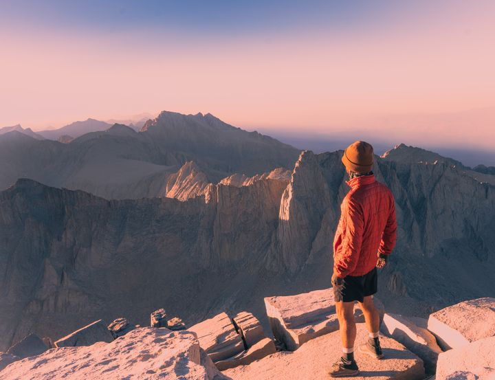
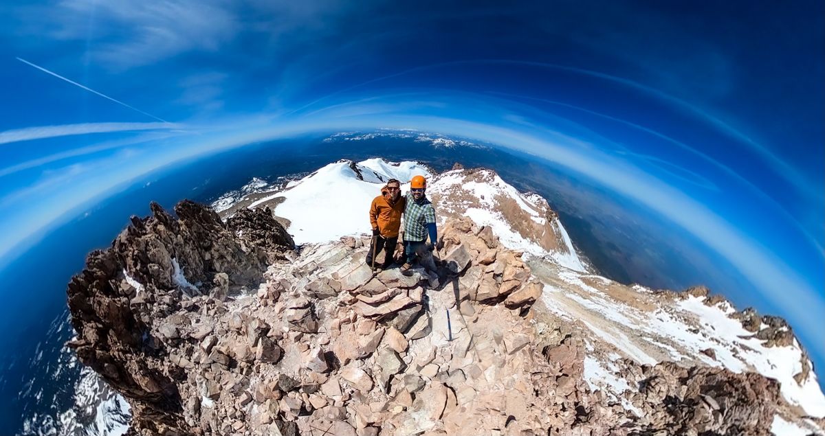
The final push passed by quickly, and before we knew it we were standing next to the summit register, twirling around to the three hundred and sixty degree views from the peak.
When we got back, these two spots were key:
- Pipeline Craft Taps and Kitchen - The Widow Burger and the Pipeline Burger were both excellent. Good beers on tap too.
- Monte Bianco Inn. Nothing fancy. $100 for a place to stay with bed and hot shower. Honestly, the bed was incredibly comfortable and exceeded expectations in that regard.
We were up early the next morning and made our way back!
The Weird Stuff
Lemurians. There is a cult of people who believe that a technologically advanced society called the Lemurians, lives inside the mountain at a place called Telos. Can't make this up. Do a Google search for "Mount Shasta Spiritual Tours" and you'll see what I mean. Walk around downtown and look for spiritual energy shops selling rocks and slat crystals. They are easy to spot as most of them have purple wooden trim around the doors and windows. For a small fee, you too could achieve a high vibrational state, tour Mt. Shasta in 5D, and activate your internal energy. Or you could do it for free. Driving to Clear Creek Trailhead we spotted a dreadlocked woman on the side of the road sitting in lotus position performing some interesting arm-waving motions that must have been for maximum energy accumulation. Optimal vibrations achieved.