PCT CA Section A - Campo to Warner Springs - 109.5 Miles
This post is part of a series I am writing to highlight different sections of the PCT and is designed to be a companion to my similar YouTube series. Links to those will appear here as I continue with the project. You can explore the section through the interactive GPS route I've loaded up on Gaia.

Click here for the Interactive Map of PCT California Section A.
Introduction
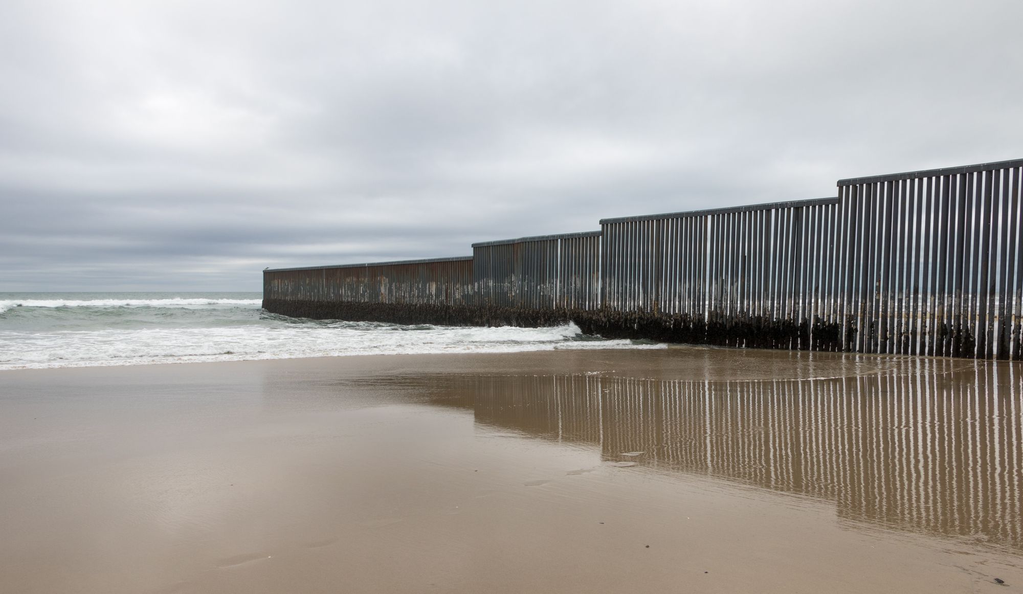
Boom. You're on the Pacific Crest Trail. Chances are you've been anticipating this moment for some time now, and here you are. You might linger for a minute to savor the moment. Feel the warm air glide past you, push some dirt around with your shoes (hopefully you bought some good ones), write down your name and a nice quote in the trail registry. Can you think of something besides "not all who wander are lost" please? You can gaze at the towering border wall and maybe see patrollers zip past in trucks and ATVs. But it wont take long to realize you've reached that moment where you need to point your nose to the north and start shuffling those tender feet.
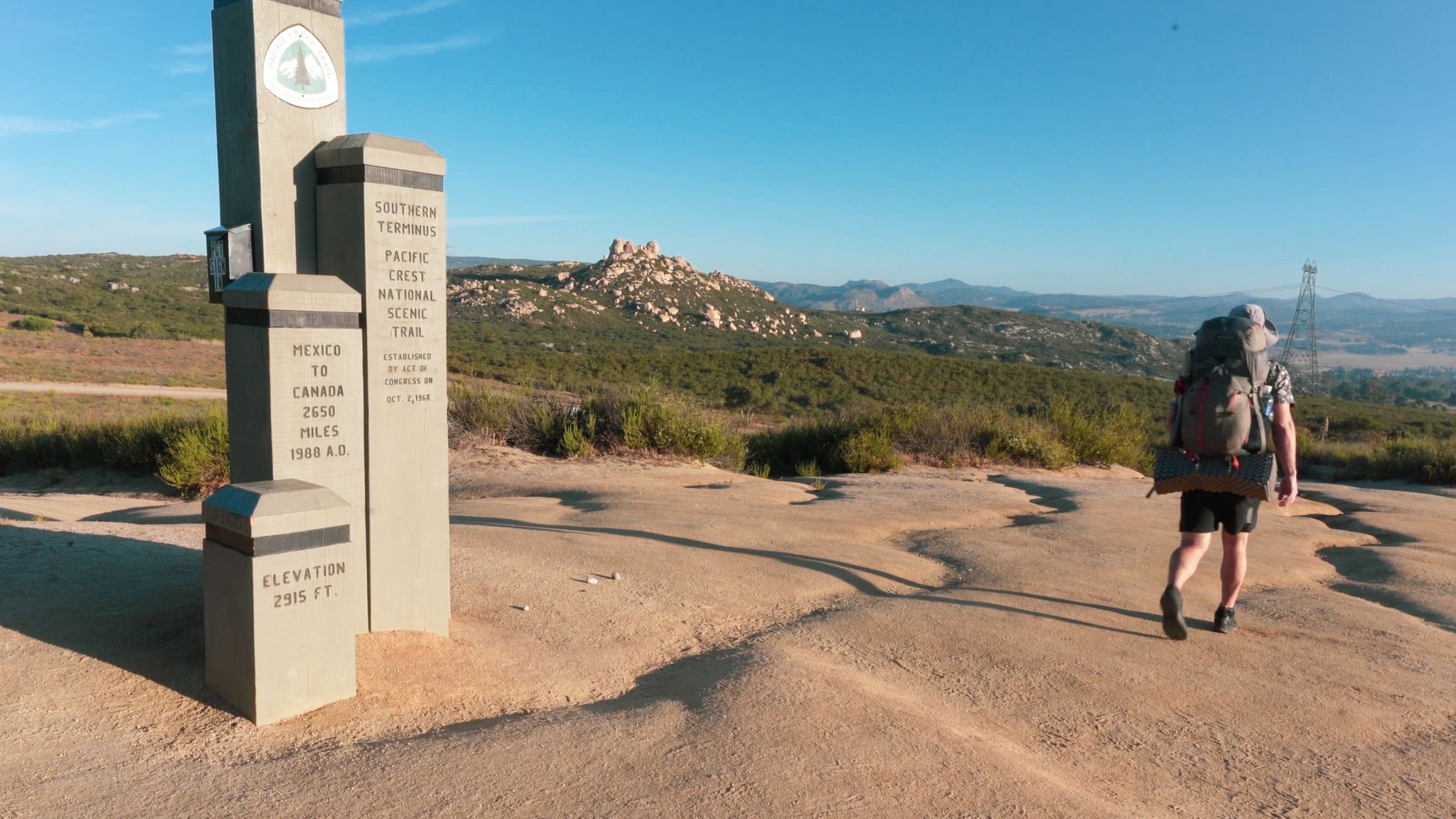
Southern Terminus (Mile 0)
The Southern Terminus stands atop a small hill near the line we've drawn between Mexico and USA. It's a rather unassuming monument considering the adventure that you are about to undertake and shrinks next to the towering wall built to prevent a different kind of northbound hiker (immigrants) from joining you on the PCT. Thinking on it, your adventure may pale in comparison to theirs. But try not to think too hard on it. Chances are you came out here to avoid the politics of these things. Go ahead, place your hand on the terminus and begin your journey. It starts with a step, maybe two, then a mile. Do that 2,650 or so more times and chances are you'll bump in to Canada! That's the goal, right?
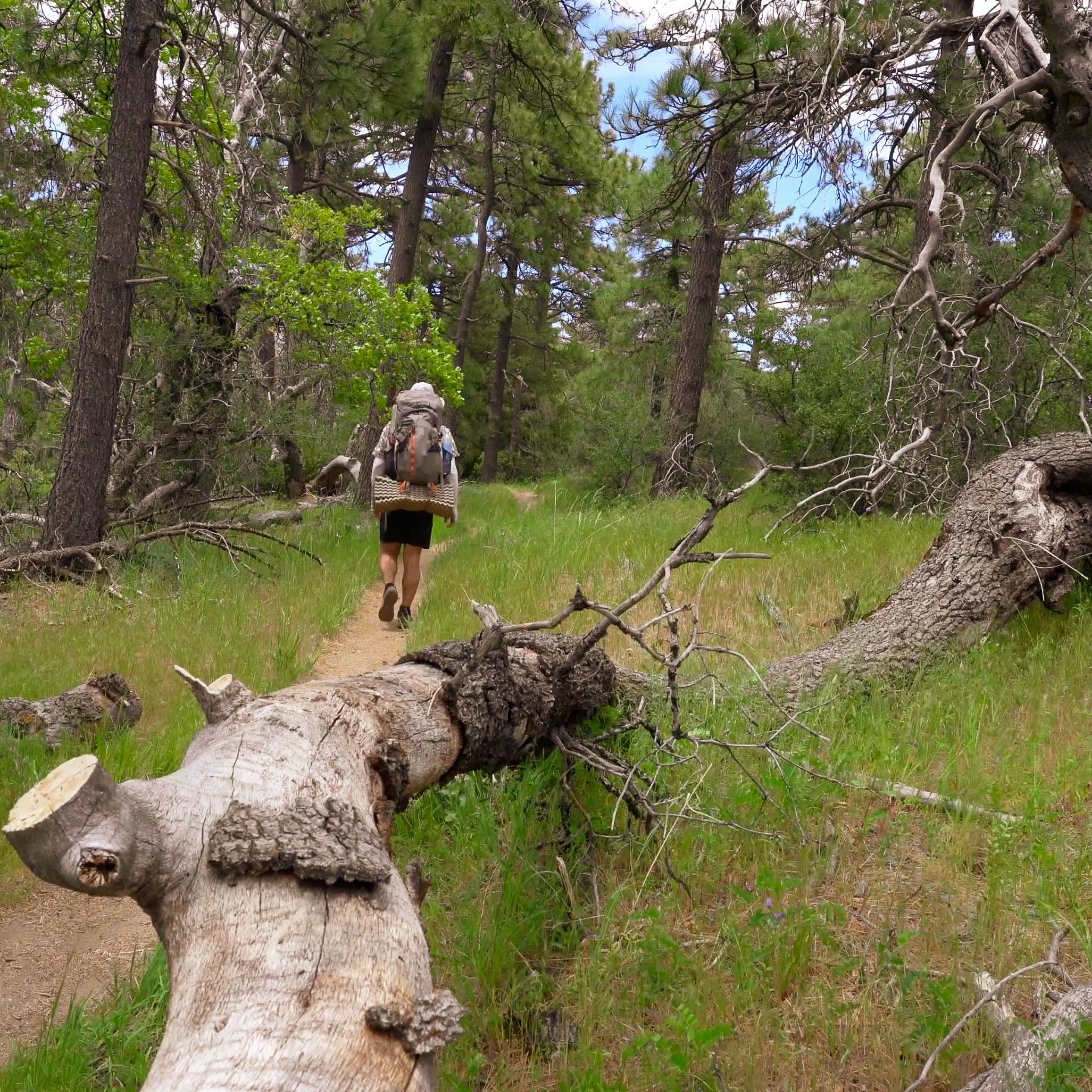
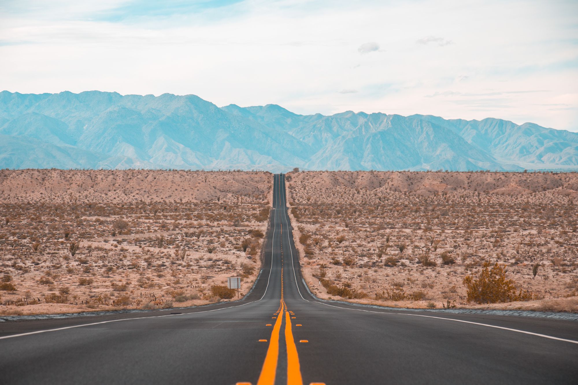
The first 40 miles from the border to the small town of Mount Laguna offer a pretty good idea of what you should get used to for the 650 mile Southern California section of the PCT. You'll walk trail characterized by dry, waterless stretches which sometimes exceed 20 miles and switchback thousands of feet up and down chaparral-laced canyons. There are few escapes from the sun. Get ready to sweat.
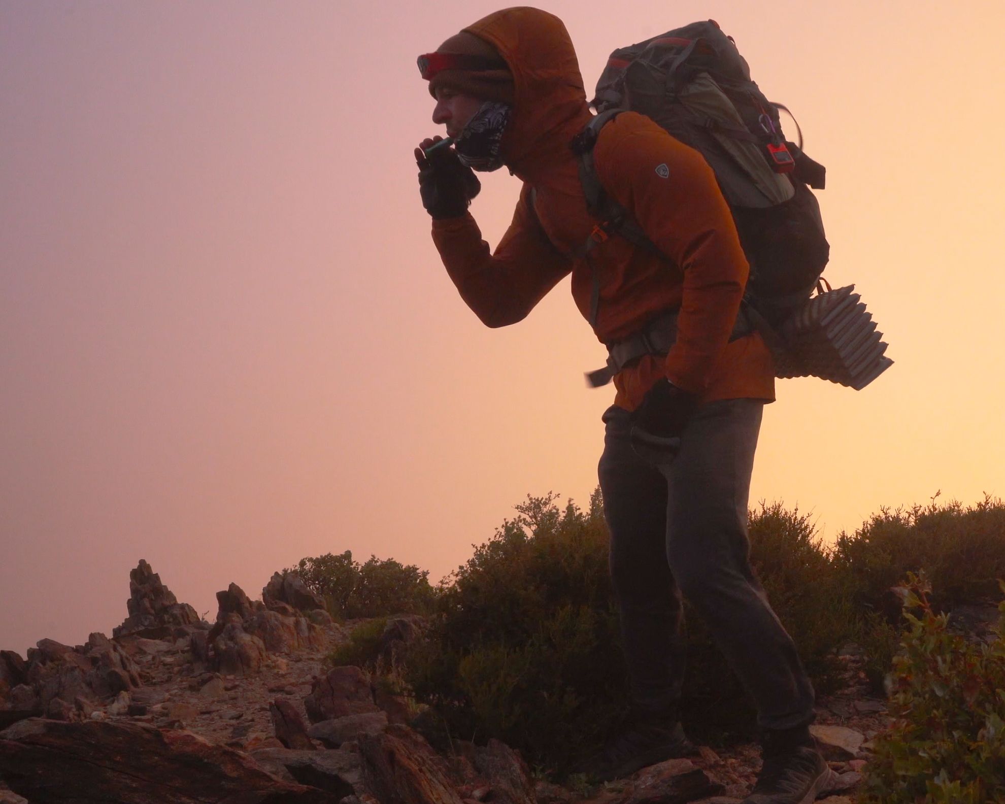
Be prepared for cold, windy days too. The temperature here can drop significantly after the sun dips below the horizon. On just my third day on trail a few miles north of Mount Laguna at 6,000 feet of elevation, I woke up in a cloud to a damp sleeping bag, whipped by wind, and was forced to don every article of clothing in my backpack, gloves included! In some years, snow will even linger into late May on Mount Laguna.

Morena Reservoir (Mile 20)
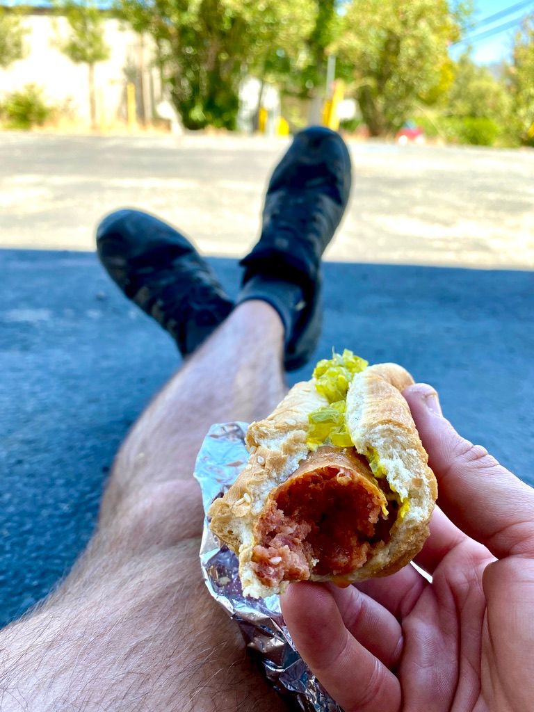
Starting off from Campo, you'll chance at water in the first 3 or 4 miles, but beyond that, the first reliable source isn't until Morena Reservoir at mile 20. On my hike, the water report indicated there were stagnant pools at Hauser Creek (mile 15.4) but I opted to push on to the faucet water at the Reservoir campground. Passing through there, you'll have the opportunity to detour 0.3 miles off trail to the Oak Shores Malt Shop for your first hiker trash cheeseburger and milk shake. I'd recommend it, even if you aren't yet struck by hiker hunger.
Of note, the store is well stocked. This was the first (but not the last) time that I felt silly for the amount of food I was carrying in my backpack. I had 6 days worth thinking I wouldn't have a decent resupply until Warner Springs. Boy was I wrong. I have no particular diet restrictions. In fact, I'll defile my body with anything that has calories, especially when they come from carbs. Moreover, I had gone on plenty of wilderness backpacking trips before this, but never a thru hike. Oak Shores Malt Shop was my introduction to the difference in logistics between the two. To be a bit more specific, I didn't yet firmly grasp the concept that if you are flexible with what you eat, you can keep your pack light by utilizing more frequent resupply stops rather than bulking up on food in anticipation of a week or more away from civilized grocery stores.
It's another 4 miles to Boulder Oaks Campground, where I ended my first day on trail. The campground has standard water faucets, vault toilets, and picnic tables. I believe the cost for a site is $14, but I was in after 9:00 PM and out at 5:00 AM and didn't even see a pay box.

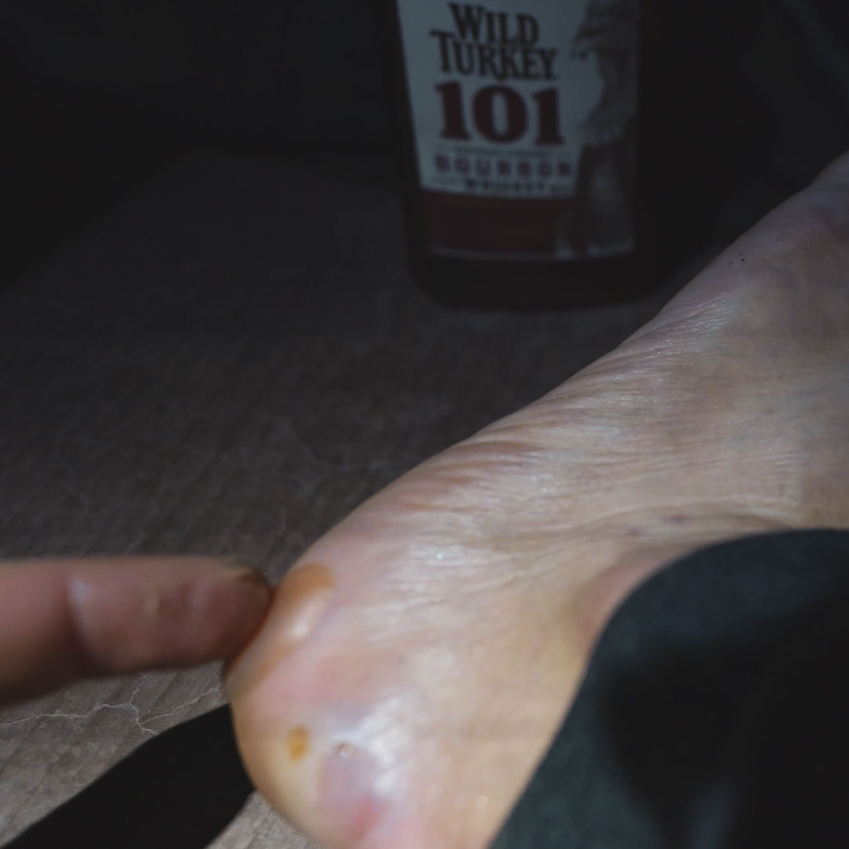
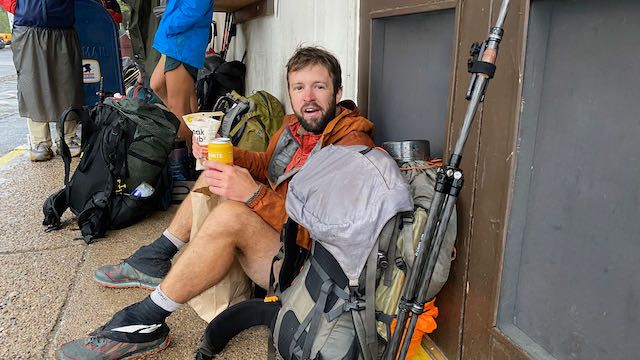
🚨 Warning! 🚨 You may be at risk for extreme motivation if you've been anticipating your thru-hike like I have. If you end the day with big bulbous blisters as I did, try to dampen the motivation to move for a minute and spend some time taking care of your feet. Ideally, do it sooner, before the blisters bubble up. I spent a solid 6 months preparing for my thru-hike by running big miles on trail, but NEVER with a pack on 🤦♂️. Don't let blisters surprise you like they did me. I eventually had to take 2 days off trail by Silverwood Lake to fix my feet. I REALLY recommend the book Fixing Your Feet to learn about all the problems you could face on your thru-hike, and how to prevent them in the first place.
Mount Laguna (Mile 41)
I woke up and began the well-graded climb into Mount Laguna. The added elevation is evident as the ubiquitous chaparral gives way to some of the first conifers and the air cools off a bit. You'll get another chance for some trail food at Pine House Cafe & Tavern in addition to a resupply at the General Store just a bit further up the highway. A French couple runs the place, and it shows in the menu. I strayed from my usual cheeseburger order and went with the French Hotdog which was essentially a hotdog trying to masquerade as a Croque Monsieur. It was a great effort, but I'd recommend something else if you swing through here. 😆
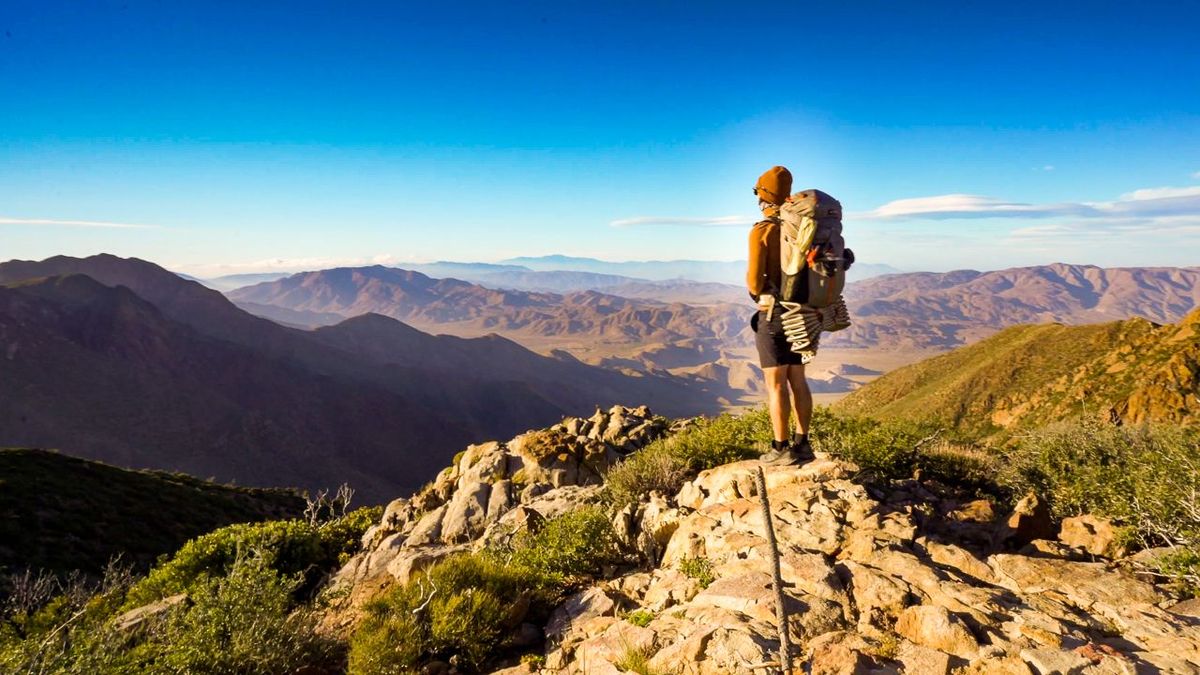
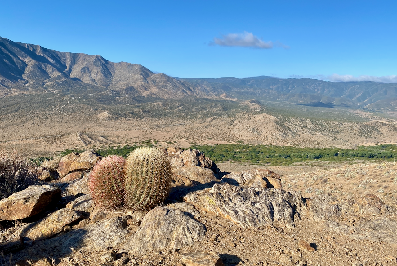
The slow descent passes by Garnet Mountain and Oriflamme Mountain and offers your first spectacular vista looking down into the Anza-Borrego Desert. The PCT never actually enters the famous desert park, though it skirts the edges to show off some of the desert flora which is uniquely adapted to thrive in the dry climate (more on that below).
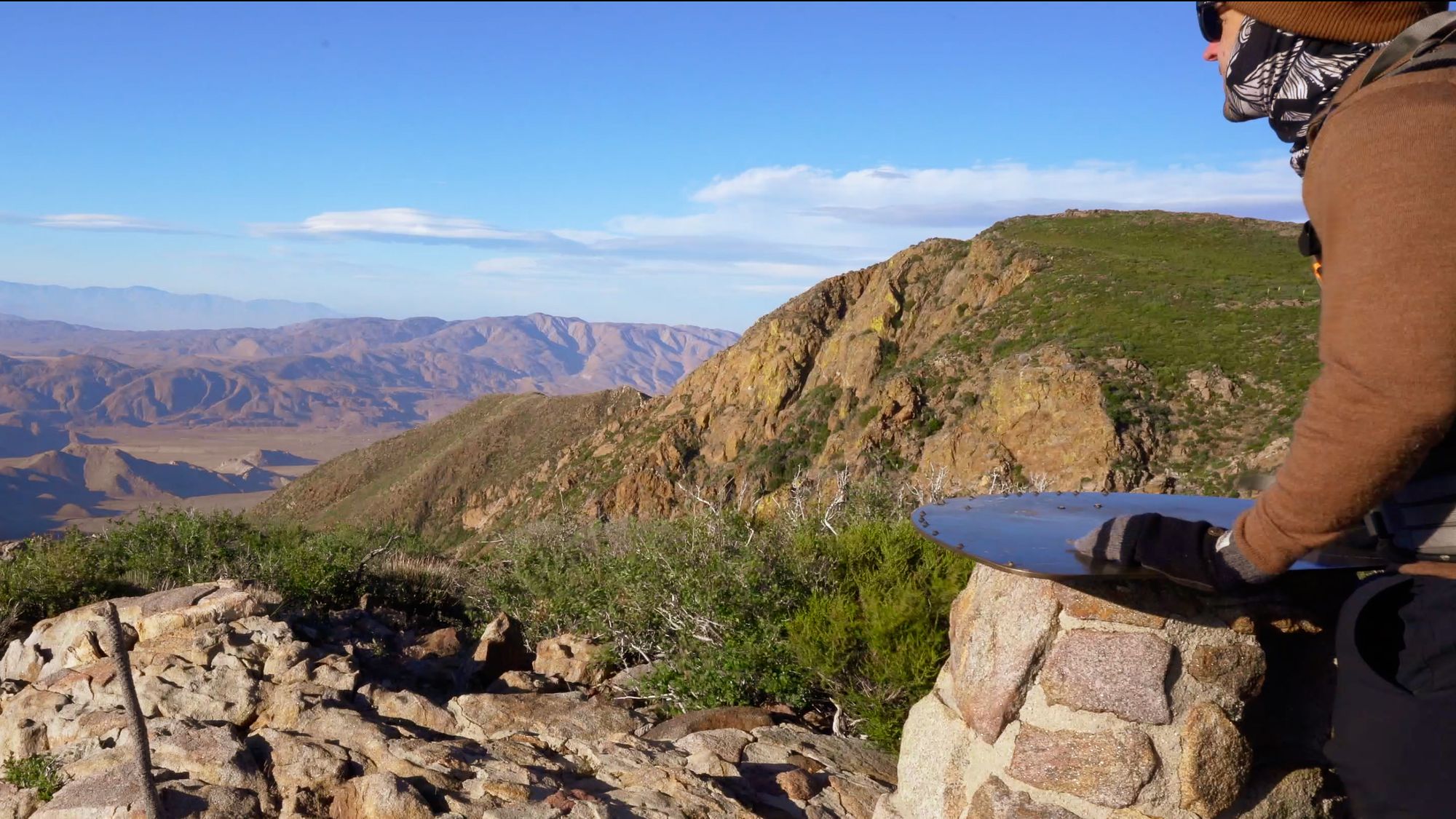
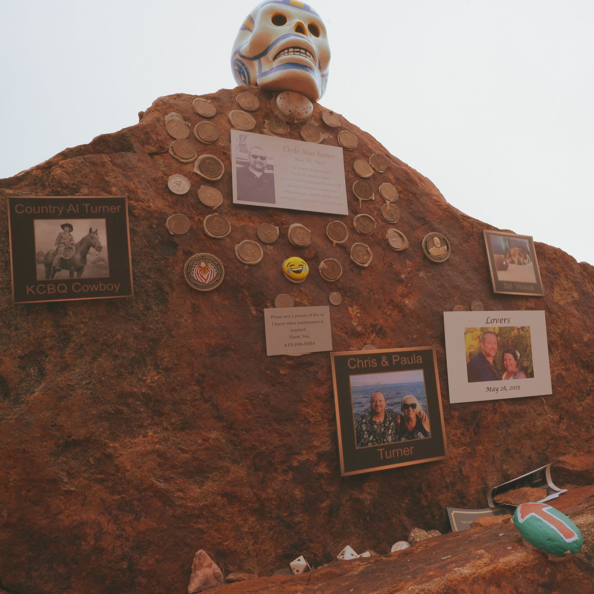
At a water trough for horses at mile 52.6, the trail turns on to the Pioneer Mail Trail. The wide trail features more scenic overlooks and can be a popular spot for hang gliders and day hikers. It was crafted in the 1800's as a mail and cargo route to be traversed by stagecoach, though the Jackass Mail System and Buterfield Stage were expensive to use and short-lived. Plastered in among the rocks are memorials, photos, and plaques dedicated to various people (hang gliders perhaps?) who enjoyed the majesty of this viewpoint. I opted to slow down for a bit to read the inscriptions and admire the mystery of death.

Scissors Crossing and San Felipe Valley (Mile 73)
Scissors Crossing at San Felipe Creek on highway 78 gives the first taste of the few wonderful hiker oases located along the PCT. As the trail has grown in popularity, some of difficulties of finding water in the Southern California section have been alleviated by trail angels who cache water, snacks, and/or supplies at convenient points along trail. Additionally, many folks will opt to hitch 12 miles to the west here into the town of Julian for a resupply and to sample the free pie and coffee offered at Mom's Pie House (just show your PCT permit).
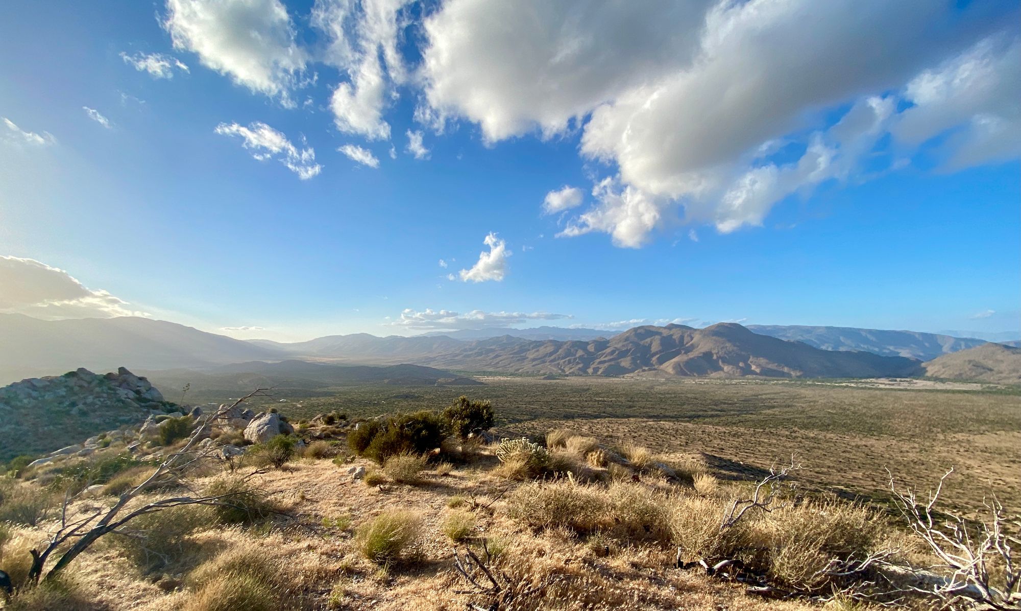
I skipped the hitch along with the pie, still way too motivated to crank miles despite an already noticeable limp from foot blisters and ankle aches. The hike wanders along the west side of the San Felipe Hills for 24 miles before the next water source. The San Felipe Valley below offers some more beautiful views, though you may get bored of it since you'll be staring at it most of the day. This part of the trek was long and took most of the day. Across the valley you'll glimpse the Volcan Mountains, which appear a bit more hospitable to hikers by their green color and rain-shadow cloud cover. In fact, trail managers originally proposed routing the PCT through these mountains, but heavy disagreement with landowners and other various government agencies resulted in the trail being laid as it is today.
I made it that evening to Barrel Springs Campground just before of Montezuma Valley Road, where a water pipe and trough dense with croaking frogs make it a popular spot to make camp.

Warner Springs (Mile 109.5)
Heading north out of Barrel Springs I was surprised to find myself walking through arid and open grasslands, coursing in the wind and speckled with clumps of granite. I haven't been to Africa before but I have watched enough Planet Earth to feel like I was in that land where a cackle of hyenas may be hiding prone in the grass with vultures flying overhead in wait. The trail passes a popular photo-op at Eagle Rock, and then hooks in to the tiny town of Warner Spring.
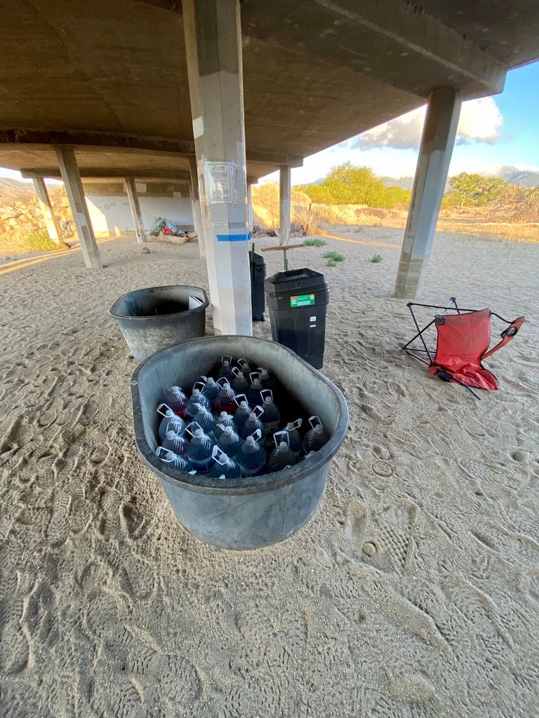
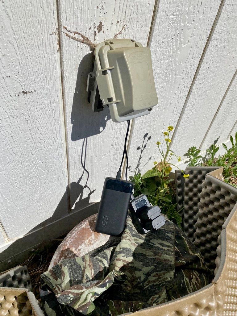
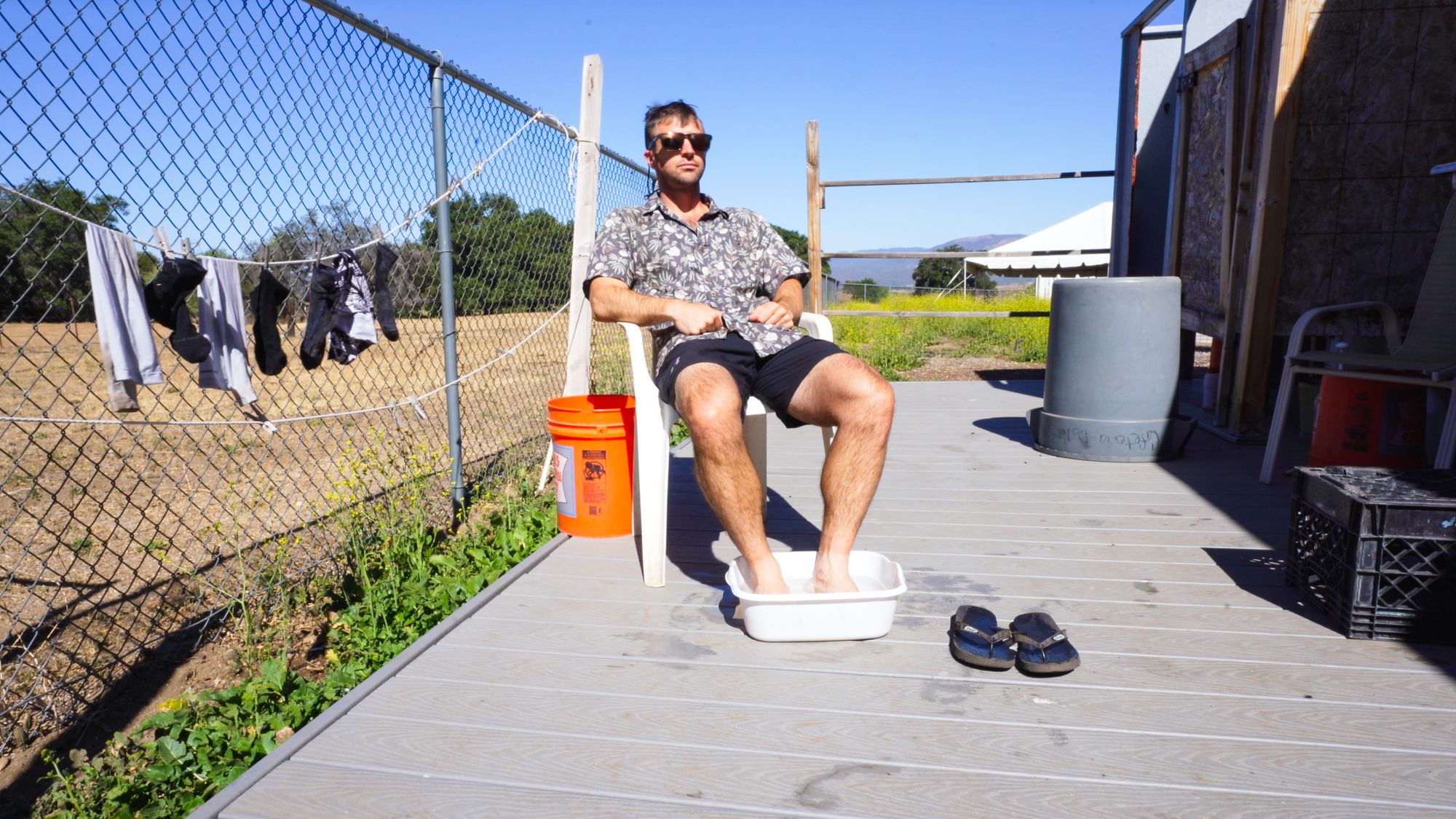
Right off the trail is a community center which supports hikers by offering a charging receptacle outside, a sink and buckets out back for hiker showers and laundry, and snacks for purchase inside if open. I took the chance to wash up a bit and charge my external battery before grabbing a quick 1 mile hitch to the gas station for a polish dog and to resupply on snacks. There's an odd feeling of joy that comes from eating gas station hot dogs on the ground in the parking lot. How dirty and simple can life get? That's what we're here to find out after all.

Learn Things
The Mexico-United States Barrier (aka The Border Wall)
Much more a steel fence of obelisks than the concrete wall often hawked in headlines, just seeing the border between USA and Mexico in person made me feel like I was gazing upon some sort of important monument or wonder of human engineering. It's really quite massive. Regardless of your stance on immigration, I wont be sharing one, the barrier is astounding enough to carry your thoughts away from the personal journey ahead to the human condition, equity in society, and political hot topics.
Imagine your an immigrant embarking on your way to a better life in a country touted for it's economic opportunity. You want to secure a better life for your family. And then you see this.

Yea... I'd probably turn around at that point unless I remembered to pack my climbing gear. But after a little bit of reading, I discovered that most of the 1,954 miles of border is actually unfenced! Moreover, while this stretch of fence was built during the Trump administration, it was in fact replacement fence and not new fence.
Here are eight things I learned in about 30 minutes of light research:
- The last statement by The Department of Homeland Security said that of the 1,954 miles of border, 649 miles of it have some sort of physical barrier. This barrier ranges from the hulking monoliths above to standard wire fencing (~350 miles) to cross-shaped vehicle blockades (~299 miles).
- Vast stretches of border without fencing require a great deal of desert travel in Arizona or navigating across the Rio Grande River in Texas. These section often have "virtual fencing" or cameras and motion detectors monitored by Border Patrol.
- Border Fencing has been constructed or retrofitted in pretty much every administration since Bill Clinton. Most recently, President Joe Biden signed an executive order on his first day in office to pause any border wall construction. He maintains the deployment of 3,000 national guard troops at the border to police human and drug trafficking.
- Wall effectiveness is hotly debated. Research at Texas A&M and Texas University claims that a border wall wont be effective at reducing illegal immigration or movement of contraband yet US Customs and Border Patrol officials continue to call for more.
- Most drug smuggling is found in San Diego, where some of the largest and most secure fencing exists.
- Wildlife preservation (jaguars and butterflies), ancient Native burial grounds protection, and private land ownership further complicate border wall construction.
- More than 80% of people detained crossing illegally north are of non-Mexican citizenship.
- I hesitate to make any statements about rising or declining levels of attempted illegal crossings, as most of the data is reported via number of Border Patrol apprehensions, which seems suspect to multiple confounding variables. One report stated that estimates on number of migrant deaths suffered from attempted border crossings is underreported by 25 to 300%.
I'd encourage you to read a bit about it yourself to really take in the experience of being at the wall outside a major arterial crossing. My favorite resources were USA Today's 2018 Pulitzer Prize winning border wall traverse and of course, Wikipedia.

Rain Shadows
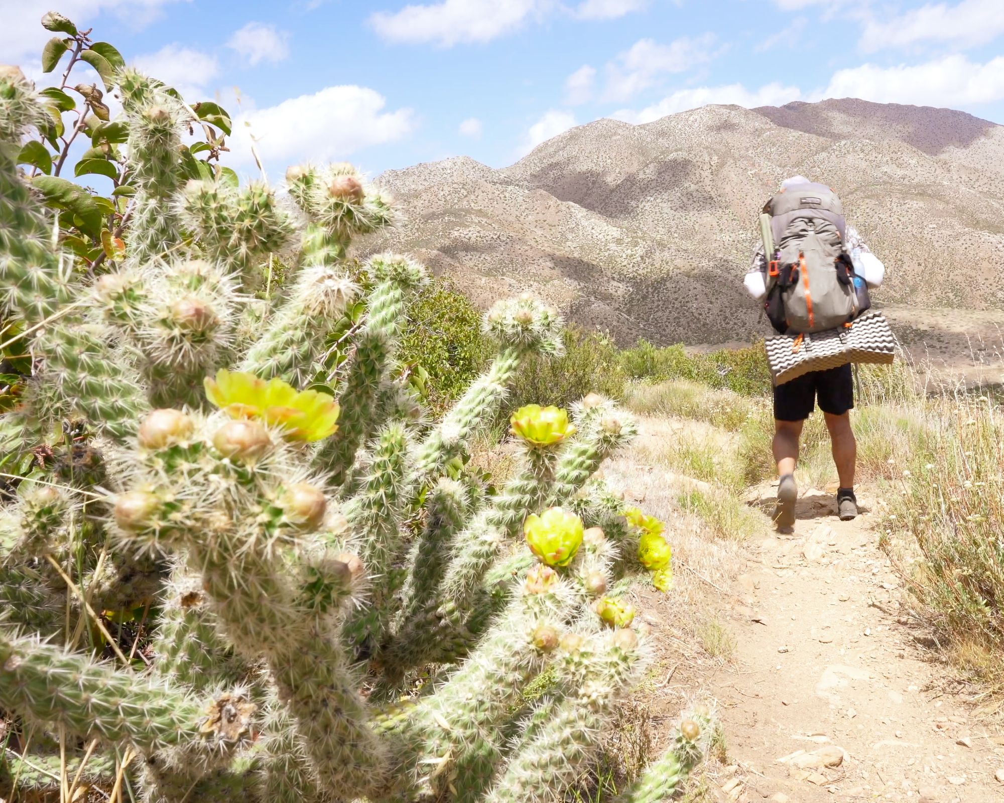
Here's a fun fact - most of the Southern California section would be called "arid land" and not "desert" by an ecologist. You know, they're those folks who walk around with too many pockets on their clothes, big hats, and round-rimmed glasses. Apparently deserts are classified as locations that have 10 inches (25 cm) of rain or less, though other factors can apply. Like I did, you'll probably tell the ecologist to bug off with his definitions as you try to avoid getting cactus spikes stuck in your thermarest when you settle in for a nap at 1PM to wait out the 105 degree F heat.
Another way to avoid the height of heat in mid day is to get high yourself. Elevation is the key. Don't be fooled, the "desert" section of the PCT is far from flat, and includes some of the largest swings in elevation outside the Sierras. A rule of thumb to keep in mind as you hike these hot sands: climbing 1,000 feet is the ecological equivalent of hiking 170 miles north, meaning the temperature drops 3 to 5 degrees F.
Just 20 miles in to your journey you will find yourself at 6,000 ft. in the Laguna Mountains where the cacti and chaparral give way to pine and fir trees. Rain shadows occur when mountains force moist air upwards with the prevailing winds. In California, moist air comes in from the Pacific Ocean to the west where it is sent skyward by the San Jacinto, San Bernardino, and San Gabriel Mountains. As the temperature drops with the added elevation, the moist air condenses and forms lovely clouds in the sky which drop their water on the western slopes. As the clouds continue to creep east, they lose their "steam" and quickly disappear as the dry heat of the desert takes over. Any rain that is shed on the eastern slopes doesn't hang around long as it passes through sand and loose rock.

Anza-Borrego Desert State Park and de Anza Expedition
The PCT never passes through what is California's largest state park, but it does kiss the edge for roughly 90 miles or so. Hikers rejoice, better to have a taste of the desert than to pass directly through the prickly frying pan. For early settlers coming from west from St. Louis and north from Mexico, the Anza-Borrego desert offered one final challenge before arriving at California's golden waters.
The desert is partly named after Juan Bautista de Anza, who in 1776 led an overland expedition of 300 settlers through, more than half of whom were women and children. The Spanish desperately wanted a better way to link their series of missions up the California coast and to establish a presidio (military fort) in what was called Alta California, now San Francisco Bay. They were losing many ships to coastal California waters and figured an overland route would provide a means to convey greater quantities of livestock and settlers to the north. In just 8 months, the de Anza Expedition made the 1,800 mile journey with only a single fatality. María Piñuelas gave birth to a healthy baby boy but died due to complications of childbirth. Seven other women were pregnant at the outset of the journey from Mexico. The expedition is commemorated today by the Juan Bautista de Anza National Historic Trail.
The second half of the desert's name, Borrego, comes from the bighorn sheep native to the area.

Desert Plants
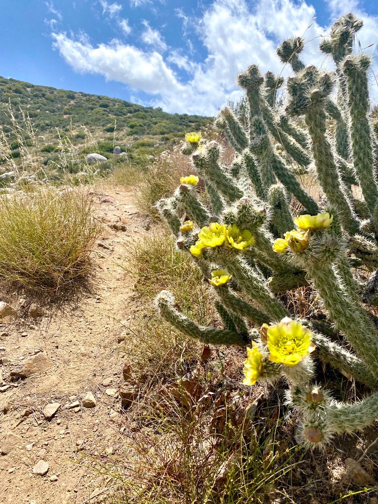
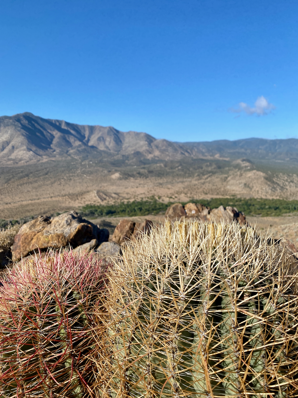
With little rain available to quench their thirst, desert dwellers have evolved to be highly drought tolerant. Cacti flourish. They are experts at water retention. Giving up leaves for spines provides a way to reduce the organism's surface area, which means less water loss through transpiration. The fleshy stem made of succulent tissue performs all the tasks of plant life like photosynthesis and reproduction.
Cacti have root systems that are shallow and wide in hopes of netting precious water. Moreover, they are nocturnal, opening their stomates (pores) only at night to take in carbon dioxide for photosynthesis. As sunlight is also required for this process, cacti store the CO2 as a weak acid until daytime when they can rev up the food-producing process.
Beyond general adaptations, each individual goes to great lengths to hold on to water and avoid death by desiccation. The spines of the teddy-bear cholla are so densely packed that they shimmer and reflect sunlight of the waxy flesh. Ribs on silver cholla and cotton tops are another method used to dissipate heat. Check out the beavertail cactus and you might notice the south-facing sides of its flesh have thicker skin than the north-facing counterparts, another shield from the sun. Prickly pear often grow perpendicular to the sun to minimize exposure. Barrel cactus are likely to grow in a slightly southern direction, a tactic that could even prove useful to a lost hiker!
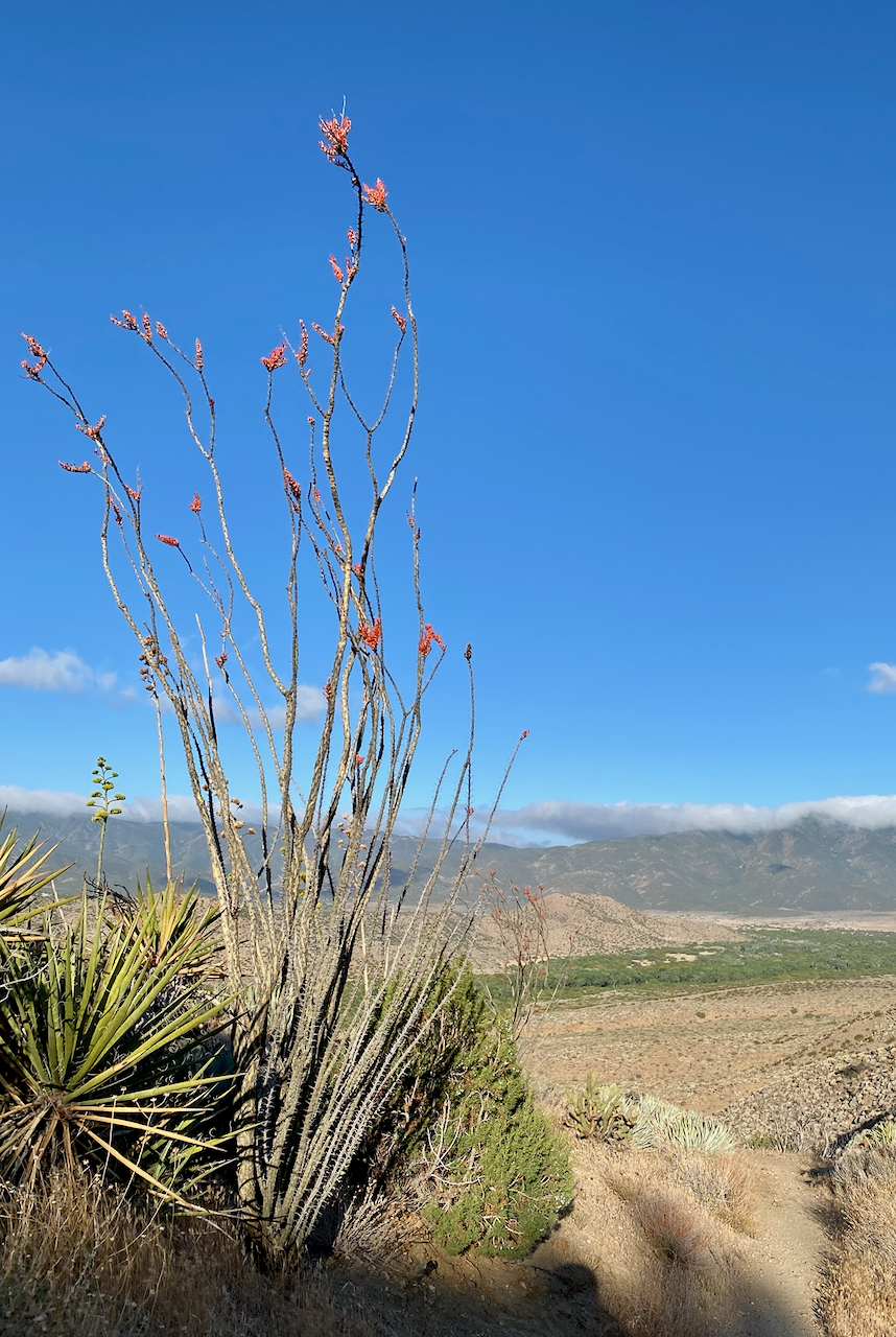
As you climb out of San Felipe Creek at Scissors crossing, be on the lookout for some octillo plant. This unique plant does not have the typical succulent tissue or nocturnal photosynthesis cycle of the nearby cacti. Instead, it uses "idling metabolism" to survive the harsh desert. Lying dormant and looking like a collection of dead sticks for years, the octillo springs into action whenever rain falls. It grows leaves which conduct photosynthesis in the span of a few days after which they die and the octillo lies dormant again until the next rain. Translating to "little torch" in Spanish, the octillo also offes a brilliant red flower pollinated by hummingbirds.

Coulter Pines
Coulter pine trees can be found in abundance between 3,000 and 6,000 feet of elevation as you make your way out of Warner Springs. The needles of the Coulter Pin come in bundles of three, but you are more likely to identify this tree by its jumbo-sized cones, which can weigh up to eleven pounds and are the heaviest in the world. The slender cones of the Sugar Pine can be longer, but due to the density of Coulter Pine cones, workers are advised to wear hardhats when nearby as the tree has earned the nickname "Widowmaker" by locals. Hikers are advised to look up when when choosing a campsite or spot to rest!